Mt. Nosoko (Maapee) | Ishigaki's No.1 View, Hiking Route, Parking & Love Legend Guide
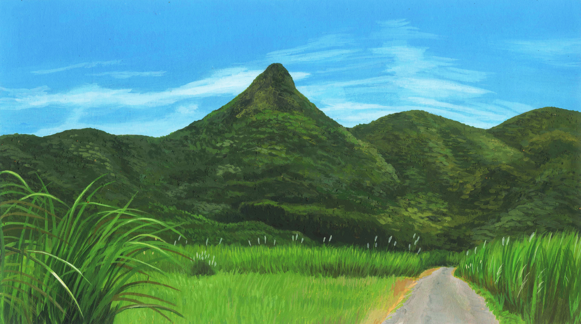

In northeastern Ishigaki, towering with a triangular silhouette at the base of the Hirakubo Peninsula, Mt. Nosoko. Beloved locally as “Nosoko Mape” from a sad love legend, it’s Ishigaki’s second-highest mountain at 282 m elevation. A superb-view mountain selected for “Japan’s 100 Island Mountains” too, a 360-degree panorama view spreads out from the summit.
There’s a petit-climbing route of 20–30 minutes one way even climbing beginners can challenge casually, and the easy course where you can go to the 8th station by car is hugely popular. The “Ishigaki No. 1 superb view” surveying sea, mountains, town and horizon definitely fascinates those who visit. In this article, we’ll deliver a complete guide to Mt. Nosoko’s appeal, legend, climbing route, access, and cautions.
What Kind of Mountain Is Mt. Nosoko (Mape)? Ishigaki’s Second-Highest Superb-View Mountain

Mt. Nosoko is a 282-m-elevation mountain located in northeastern Ishigaki, in the central part of the Nosoko Peninsula. Following Mt. Omoto (525.5 m), Okinawa Prefecture’s highest peak, it’s Ishigaki’s second-highest mountain. The summit’s pointed triangular shape is distinctive, a symbolic presence of the island that you recognize at a glance as “that’s Nosoko” from various places on Ishigaki.
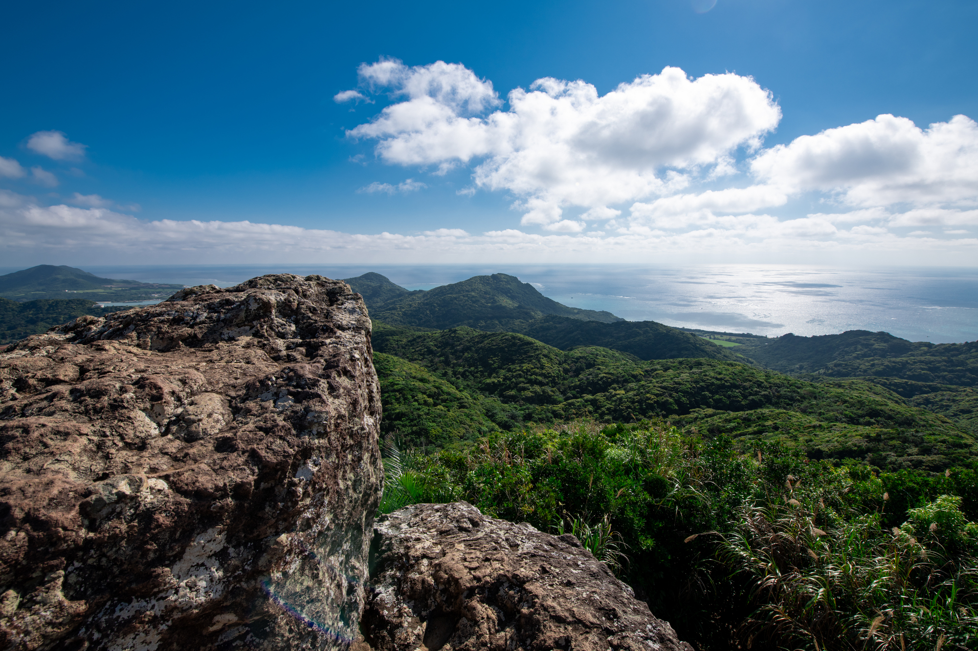
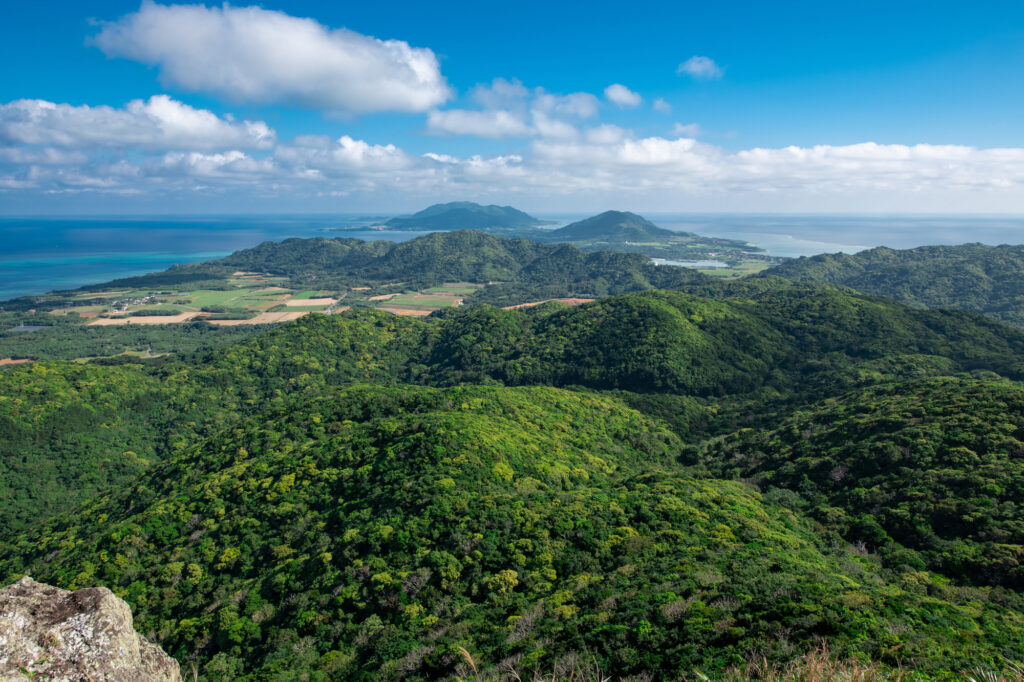
Though the elevation isn’t that high, the view from the summit is exceptional. The blue sea spreading below, the green-rich forest, scattered settlements, far-off remote islands—you can enjoy scenery in a class of its own even on Ishigaki, a “treasure house of superb views.” A popular spot many people unanimously call “Ishigaki’s most beautiful scenery.”
Nosoko Mape’s sad love legend
Mt. Nosoko being called “Nosoko Mape” too is from a sad love legend connected to the summit. It’s a tragic love story of one woman, brought about by the forced-migration system called the “michi-giri-ho (path-cutting law)” of the Ryukyu Kingdom era.
Long ago, a young girl named Mape, living on Kuro Island about 20 km from Ishigaki, had a beloved sweetheart named Kanimui. However, due to the Ryukyu Kingdom’s forced-migration policy, Mape was forced to migrate to Nosoko Village, and the two were torn apart.
Mape, unable to sever her feelings for Kanimui, climbed to the summit of Mt. Nosoko wanting to see at least the direction of Kuro Island. But the scenery visible from the summit was blocked by the huge Mt. Omoto, and Kuro Island couldn’t be seen.
Mape, falling into despair, turned to stone right in her praying posture at the summit—.
From this legend, Mt. Nosoko came to be called “Nosoko Mape” as “the mountain with the stone of Mape’s praying figure.” Nowadays, rather than the stage of a sad story, it gathers popularity as a love-fulfillment power spot.
A famous peak selected for “Japan’s 100 Island Mountains”
Mt. Nosoko is a famous peak selected for “Japan’s 100 Island Mountains,” chosen by the Japan Remote Islands Center. Though the elevation is modest, the superb view from the summit and its distinctive cultural background are highly evaluated. Having been introduced in the Degawa Girls corner on Nippon TV’s “Itte Q!” in May 2022, its degree of attention is rising nationwide too.
Mt. Nosoko Highlights | A 360-Degree Panorama from the Summit
A breathtaking superb-view grand panorama
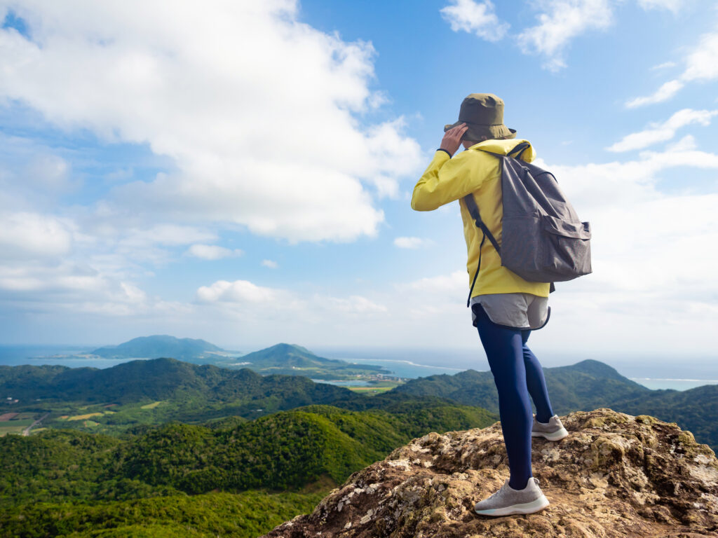
The view from Mt. Nosoko’s summit is a 360-degree grand panorama that overwhelms everyone who visits. Though the height is low, there’s almost nothing blocking the view around it, a rare position where you can survey almost the entire Ishigaki.
| Direction | Visible scenery |
|---|---|
| North | Hirakubo Peninsula, blue sea, Ibaruma Bay |
| East | East China Sea, Tamatorizaki area |
| South | Mt. Omoto, Yonehara Beach, Kabira Bay direction |
| West | West coast, Ishigaki Port direction |
On clear days, you can even see a far-off airplane landing at the airport. The three-dimensional superb view woven by sea, mountains and sky gives an emotion that doesn’t come across in photos.
The stone of Mape’s praying figure
At the summit there’s a large rock that looks like the legend’s protagonist Mape in a praying posture. You can climb this rock and feel the conquest of the summit, but the footing is a sheer cliff—be careful not to fall. Just watching from a safe place, you can feel the weight of the legend.
A sunrise / sunrise spot
Mt. Nosoko is popular as a sunrise superb-view spot too. In the summer period, around 5–6 a.m., you can see the sunrise ascending from the right side of Mt. Nosoko. Nosoko Forest Road is a hidden morning famous spot, with many people visiting in the early morning aiming for the sunrise.
Mt. Nosoko Climbing Route | Choose from Two Courses
Easy course (shortcut route) | time needed 20–30 min
Mt. Nosoko’s greatest appeal is that you can go to the 8th station by car. From the 200-m-elevation trailhead (shortcut) to the summit, it’s a petit-climb of only 82 m height difference, 20–30 minutes one way. A course ideal for climbing beginners and families.
| Item | Details |
|---|---|
| Trailhead elevation | 200 m |
| Summit elevation | 282 m |
| Height difference | 82 m |
| Time needed (one way) | 20–30 min |
| Time needed (round trip) | 40–60 min |
| Difficulty | ★★ (beginners OK) |
| Steep grade | Yes (rope available) |
Full course | time needed 1 hour
For those who want to enjoy full-fledged climbing, the full course climbing from the foot. A trailhead you enter following the “Nosoko Mape Climbing Trail” sign from the Nosoko area, a trek of about 1 hour one way. Along the way you can observe subtropical-specific plants like hikageheho too, and may even meet fireflies around March, and sagaribana flowers from mid-June to the end of July.
Watch for the steep grade using a rope
Even on the easy course, there’s quite a steep grade just before the summit. Climb carefully using the rope strung on the left and right of the animal trail. Cross the final difficult spot and the legend’s sign appears—the sign that “you’ve reached the goal.”
Mt. Nosoko Basic Information / Access
| Item | Details |
|---|---|
| Location | Nosoko, Ishigaki City, Okinawa |
| Elevation | 282 m (Ishigaki’s second) |
| Climbing time (easy) | 20–30 min one way |
| Climbing time (full) | About 1 hour one way |
| Fee | Free |
| Parking | For several cars near the trailhead |
| Restrooms | None |
| Selection | Japan’s 100 Island Mountains |
| Departure point | Time needed | Route |
|---|---|---|
| New Ishigaki Airport | About 25–30 min by car | National Route 390 → Nosoko Forest Road |
| Ishigaki Port Remote-Island Terminal | About 45 min by car | From town to the island’s north |
| Tamatorizaki Observation Deck | About 15 min by car | A nearby spot |
| Fukido River Mangrove | About 10 min by car | Mangrove + climbing plan |
Watch for the two trailheads
Mt. Nosoko has two trailheads, so choose to match your purpose.
- Shortcut (easy) trailhead: the 200-m-elevation point via Nosoko Forest Road. No sign, but a hut is the landmark
- Foot trailhead (full): turn right from the “Nosoko Mape Climbing Trail” sign
If you mistakenly choose the route climbing from the foot, it becomes a full-fledged climb of 2–3 hours one way, so be careful. Many tours adopt the shortcut (easy) course.
Mt. Nosoko Trekking Clothing / Things to Bring
Clothing
- Long sleeves / long pants: essential for scratches from vegetation / insect measures
- Trekking shoes: a slippery mountain trail, sneakers at minimum
- Hat: the summit has almost no shade
- Sandals / heels / short pants: absolutely NG
Things to bring
- Water (500 ml or more)
- Light meal / bread
- Sunscreen
- Insect-repellent spray
- Towel
- Camera
- Work gloves (if using the rope)
Cautions When Visiting Mt. Nosoko
After rain the red soil gets muddy and slippery
The soil on the climbing route is red soil, so when it rains it becomes very slippery. The day after rain or after rain, people slip and fall in succession. Choosing a clear day is recommended.
The summit is a sheer cliff | watch your footing
The summit is a sheer cliff. When climbing Mape’s large rock, be careful not to fall. On days with strong wind or signs of a thunderstorm, descend without pushing it.
Watch for habu and bees
Ishigaki’s jungle has habu too. Take measures like not carelessly putting your hand into the bushes, protecting your skin with long sleeves / long pants, making sound with a speaker, and so on.
Watch for wild animals darting out
On Nosoko Forest Road, Natural Monuments like the crested serpent eagle, ruddy kingfisher, and yellow-margined box turtle sometimes cross the road. Slow down and drive safely.
Nearby Spots to Enjoy Together with Mt. Nosoko
Fukido River Mangrove | SUP / canoe
Fukido River Mangrove, about 10 minutes by car from Mt. Nosoko. A Hirugi grove of the river with Mt. Nosoko as its source, enjoyable by SUP or canoe. You can build a nature-savoring plan of climbing + mangrove.
Tamatorizaki Observation Deck | hibiscus and a superb view
Tamatorizaki Observation Deck, about 15 minutes by car from Mt. Nosoko. A popular spot where a hibiscus promenade and the superb view of the Hirakubo Peninsula spread out.
Yonehara Beach | full-fledged snorkeling
Yonehara Beach, about 20 minutes by car from Mt. Nosoko. If you want to enjoy the contrast of mountain + sea, go snorkeling after climbing.
Akaishi Shokudo | Yaeyama soba where a line is inevitable
Akaishi Shokudo, about 20 minutes by car from Mt. Nosoko. Ideal for an exquisite soki-soba lunch after climbing.
Mt. Nosoko FAQ
Can I climb it with kids?
On the easy course, you can challenge it with children of elementary-school age and up. However, since the summit is a sheer cliff and there are scenes of steep grade using a rope, guardian accompaniment and safety management are essential.
What’s the best season?
Other than midsummer (July–August) is recommended. October–May is mild in temperature and comfortable. Since there’s no snow even in winter, it’s a mountain enjoyable through the year.
Is there a guided tour?
Yes, there are several trekking tours that can be held from 1 person. The fee is about ¥6,900–15,000. With pickup and equipment included, even beginners are reassured.
How long does it take?
The drive to the trailhead + climbing + summit stay is 2–3 hours total. You can enjoy it with leeway on a half-day course.
Is it a love power spot?
From Mape’s legend, it’s popular as a love-fulfillment power spot. Many people visit for climbing as a couple, or to pray for love.
Summary | Meet Ishigaki’s No. 1 Superb View and a Love Legend at Mt. Nosoko
Mt. Nosoko (Nosoko Mape) is Ishigaki’s second-highest mountain at 282 m elevation. Selected for “Japan’s 100 Island Mountains,” it’s Ishigaki’s No. 1 superb-view spot where a 360-degree grand panorama spreads from the summit. It’s a love-fulfillment power spot where a sad love legend remains too, leaving a deep impression on the hearts of those who visit.
About 25–30 minutes by car from New Ishigaki Airport, with the easy route where you can go to the 8th station by car, you reach the summit in 20–30 minutes one way. Combine it with the Fukido River Mangrove, Tamatorizaki Observation Deck and Yonehara Beach, and a nature-savoring drive of northern Ishigaki is complete.
Long sleeves / long pants, trekking shoes, a clear day—prepare your gear and be sure to meet Mt. Nosoko’s superb view on your next trip. Surely an emotion known only to those who’ve climbed awaits you.
Book Your Rental Car Here


※For pick-ups or returns outside of business hours, please contact us by phone.
Access
Ishigaki Island Mirais Rent a Car Ishigaki Airport Branch
783-1 Shiraho, Ishigaki City, Okinawa 907-0242, Japan
*The address above shows a wide area. For the exact location, please click “View larger map” or “Open in Google Maps.”
Ishigaki Island Mirais Rent a Car Ishigaki Downtown Branch
704 Tonoshiro, Ishigaki City, Okinawa 907-0004, Japan
*The address above shows a wide area. For the exact location, please click “View larger map” or “Open in Google Maps.”
